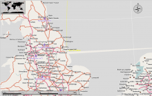
Fix for horizontally distorted boundaries between Prime Meridian in Britain and Netherlands.
ClosedPublic

Authored by tandon on Jun 26 2016, 2:31 PM.

Details

Summary

Issue
polyshp2osm.py converter used to write very small lon/lat values in scientific notation. When tiles were created using the osmconvert tool, the tool used to read only the starting digits of the value and never considered the exponenet part, which gave rise to eratic position of nodes and hence eratic boundaries.

Fix
This commit makes the converter write lon/lat values only in decimal notation thus preventing any erratic read/writes.
Diff Detail

Repository
R34 Marble
Lint
Automatic diff as part of commit; lint not applicable.
Unit
Automatic diff as part of commit; unit tests not applicable.
tandon updated this revision to Diff 4740.Jun 26 2016, 2:31 PM
tandon retitled this revision from to Fix for horizontally distorted boundaries between Prime Meridian in Britain and Netherlands..
tandon updated this object.
tandon edited the test plan for this revision. (Show Details)
tandon added reviewers: rahn, nienhueser.

This diff fixes the erratic boundary issue

nienhueser accepted this revision.Jun 26 2016, 3:17 PM
nienhueser edited edge metadata.

Good catch.

tools/shp2osm/polyshp2osm.py
603

20 seems a bit too much, I'd go for not more than 10. See also https://en.wikipedia.org/wiki/Decimal_degrees#Precision

This revision is now accepted and ready to land.Jun 26 2016, 3:17 PM
This revision was automatically updated to reflect the committed changes.
tandon marked an inline comment as done.